Vanishing Water / Aral Sea, Central Asia
The Sea That Vanished
45.0°N, 59.5°E · 1990–2025
Aral Sea, Central Asia
1990 to 2025
Landsat · 30m
USGS Landsat, processed by OrbitalStory
Explore the imagery
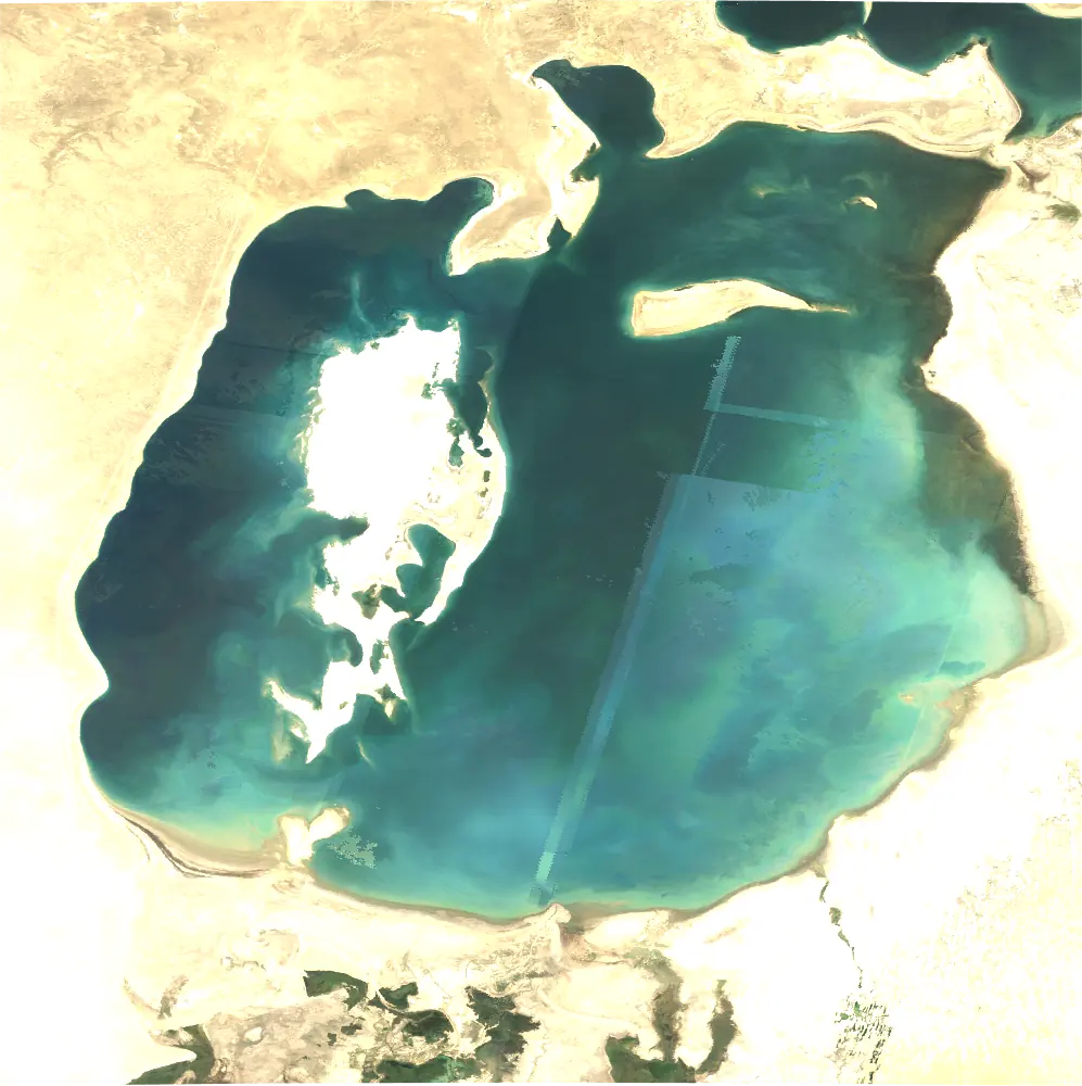
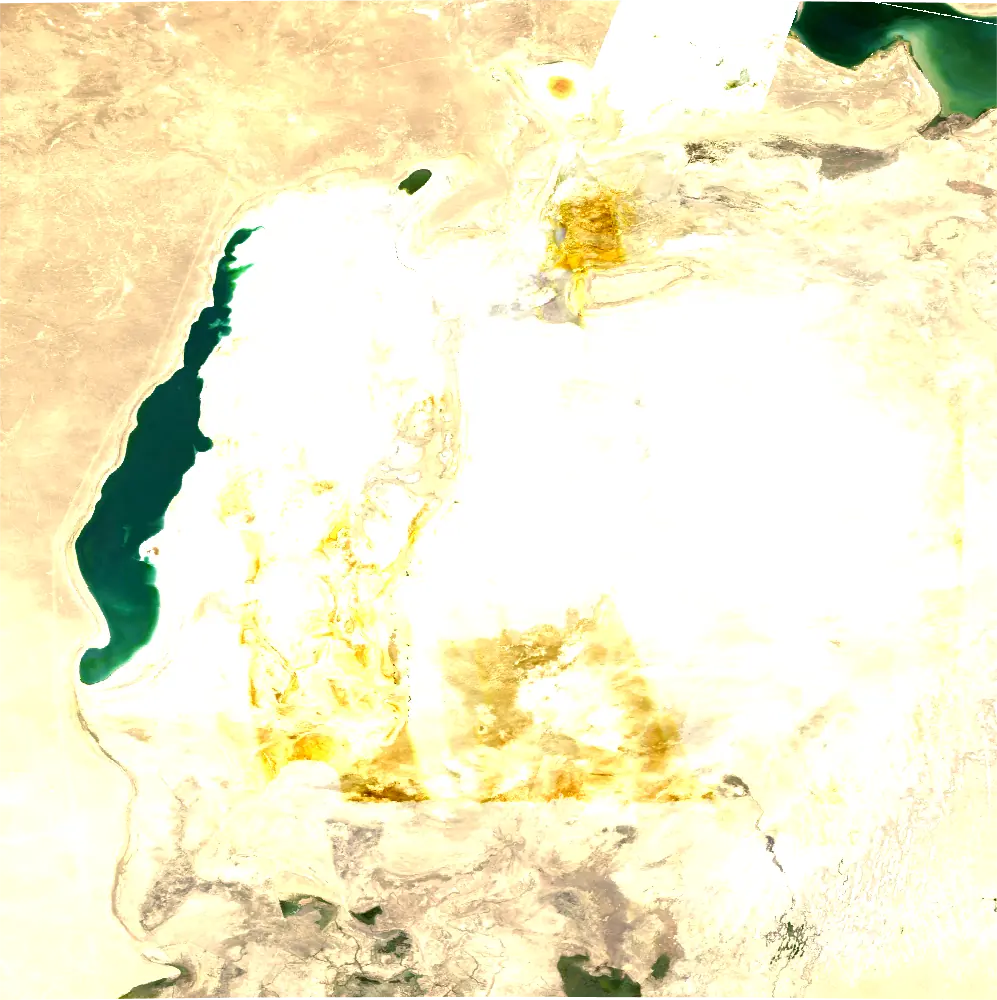
Drag the divider or use arrow keys to compare 1990 and 2025.
Image provenance and limits
Matched Aral Sea engine frames for 1990 and 2025. Same mapped extent (58–61°E, 43.5–46.5°N). Exact acquisition dates and cloud scores were not retained; visual check found no major obscuring clouds. The 1990 frame has a visible processing seam.
Imagery: USGS Landsat, processed by OrbitalStory. USGS Landsat and Copernicus Sentinel.
The story / 4 chapters
01
Once the fourth-largest lake in the world, the Aral Sea has become the defining image of environmental catastrophe. Soviet-era irrigation projects diverted the Amu Darya and Syr Darya rivers to feed cotton fields in the desert. The lake began to shrink. And it never stopped.
02
Landsat satellites have documented this transformation since the 1980s. The pale shorelines visible in these images mark where water once stood, a ghost outline of a body of water that sustained fishing communities and moderated the regional climate for millennia.
03
By 2024, the eastern basin has almost completely dried up. The exposed seabed, now called the Aralkum Desert, sends toxic dust storms laden with salt and pesticide residue across the region. What remains is a fraction of what existed half a century ago.
04
It is a story written in salt and sand, visible from any orbit overhead.
Continue exploring
Vanishing Water ↗