Rondonia, Brazil
2000 to 2024
Landsat 7 + Sentinel-2 · 10-30m
USGS Landsat 7 / ESA Copernicus Sentinel-2, processed by OrbitalStory
Explore the imagery
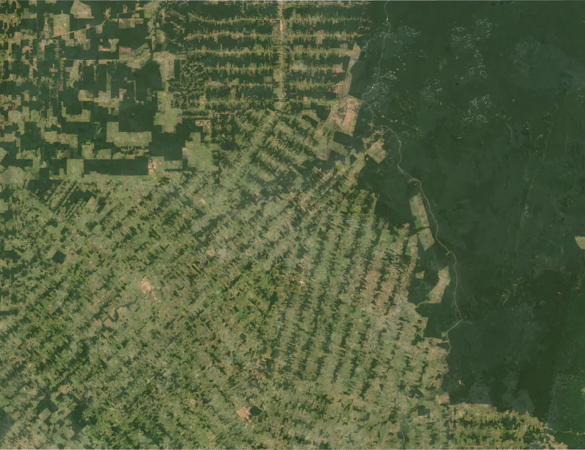
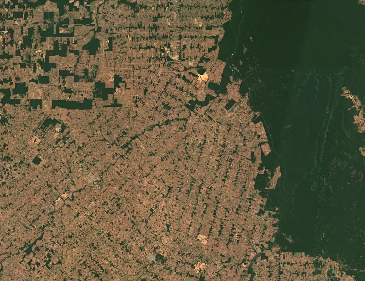
Drag the divider or use arrow keys to compare 2000 and 2024.
Image provenance and limits
Matched engine pair from the same bounding box (62.8–61.5°W, 10.8–9.8°S). Engine collection selection uses Landsat 7 for 2000 and Sentinel-2 for 2024. Exact acquisition dates and cloud scores were not retained; visual check found no major obscuring clouds.
Imagery: USGS Landsat 7 / ESA Copernicus Sentinel-2, processed by OrbitalStory. USGS Landsat and Copernicus Sentinel.
The story / 3 chapters
01
The Amazon rainforest, seen from orbit, reveals a pattern that has become disturbingly familiar: the fishbone pattern of deforestation. Roads push into virgin forest, and clearings spread outward from each one like the branches of a tree, an ironic geometry.
02
Rondonia state in western Brazil has been one of the most active deforestation frontiers for decades. Between 2000 and 2024, the boundary between intact forest and cleared land advanced relentlessly, visible as sharp geometric edges against the organic canopy.
03
Each pixel in Sentinel-2's 10-meter resolution represents a patch of ground roughly the size of a small room. At this scale, individual clearings are unmistakable. The dark green of intact canopy gives way to the pale brown of exposed soil, and once the forest is gone, it does not come back on any human timescale.
Continue exploring
Forest Frontiers ↗